Drone Technology: Is New Regulation Enough?

The disruption to flights in and out of two major UK airports, has raised many questions around the use and adoption of drones in urban areas. In response, the CAA has ushered in dramatic new regulations to ban all non-approved drone flights within a 1 km radius of airports. This however will have little or no effect on those who continue to operate illegally, unregulated, or with malicious intent.  

The disruption, which lasted more than 36 hours, in the case of Gatwick, highlights the lack of preparedness of the emergency services to deal with the potential threat of drones used in an illegal manner. What if the alleged incursion had been a drone operated with intention of carrying out a terrorist act? Would we, or should we accept 36 hours as an adequate response time in such a situation?   

The confusion over the incident is likely to involve many factors, one being the lack of ADS-B (automatic dependent surveillance-broadcast) transponders. These transponders attach to the UAV’s and transmit information such as aircraft identification, location and velocity, to air traffic control. Without this information, the supposed sighting of the unauthorised drone, becomes harder to distinguish from that of the police one.

Following this, a Flight Information and Notification System (FINS) has been proposed, which promises to deliver better communication between drone users and relevant government bodies, and authorities are being given more power to issue fines for illegal drone use. ‘This is welcome news’, commented Peter Wilder, director of Survey Drone. ‘Tougher regulation and penalties will discourage hobbyists from competing for commercial work and encourage greater responsibility among companies wishing to obtain the services of UAV operators.’  

Tougher regulation will not however remove the threat of rogue drone use, especially for the transportation of illegal substances into prisons, which is still rife despite geo-fencing measures first implemented by DJI in 2013. Therefore, it is very likely that we will begin to see a new sector emerge within the industry that deals with counter drone technology. This sector is already showing signs of rapid advancement with trade fairs such as U.T.Sec (Summit for Drones, Unmanned Technologies and Security) in Germany, focusing on drone surveillance and security systems. 

With the expansion of drone use, it is inevitable that our police force and regulations need to keep in step with the pace of changing technology. UK police forces have been slow to adopt drone technology, but this is an area that is rapidly changing, with DJI reporting that drones were involved in the rescue of at least 65 people in the year 2017-2018. This data includes incidents such as a car crash in rural England, police were unable to locate the driver, after arriving to the scene in darkness. A thermal imagining drone was deployed, which located the man unconscious in a ditch. In incidents like this, when time is of the essence, UAVs can be quickly mobilised and get to the site within minutes.

 Like all drone operators we are excited by the opportunities that are currently developing within the sector, but equally discouraged by the level of negative press that incidents, like the ones at Gatwick and Heathrow, attract. Hopefully, the industry will be as quick to adapt as the technology has, and that we will continue to see the drone services sector mature as a profession.  


New Capabilities unveiled at Futurescape 2018

FutureScape 2018 lived up to its title as Survey Drone unveiled the latest aircraft in their fleet of unmanned aerial vehicles. 

The Applied Aeronautics Albatross, imported from Texas USA, is one of the largest fixed wing survey platforms in the UK and will enable the company to undertake ever larger surveys on sites in the UK and overseas. Peter Wilder spoke about the capabilities of the Albatross at FutureScape:

“ With a payload of 4.4kg, a flight time of 5 hours and a range of up to 40km, the Albatross enables us to undertake long range surveys with a variety of cameras on board including thermal, near infra-red (NIR) and high resolution optical zoom lenses. The platform will eventually enable us to move into the Lidar (Light Detection and Ranging) field of operations.”

With a wingspan of 3m, the Albatross certainly made an impression at Futurescape, hovering above our Quest UAV Datahawk and DJI multi-rotor aircraft. Visitors were given an opportunity to get a drones-eye view of the show through our FPV goggles connected to our trusty Inspire 1 UAV and get hands on with our latest equipment including the Inspire 2 and Mavic 2 Pro.

If you missed us, but would still like to find out more about the services we offer and our prices and availability for 2019 surveys, please use our contact form.

Thanks to all those who approached our team and we hope you enjoyed it as much as we did! Keep checking our social media for our next event!  

Hao Yong – Surveying in Remote Locations

Arriving into Hao Yong Village in Hainan Province, a Mavic Pro stuffed deep into my rucksack, I felt a sense of trepidation. Not just because of foreboding clouds, government officials and barking dogs, but because of my missing friend, ally and translator, Google. After getting both sill and video footage in the bag, we set about getting our mobile device to connect via a Baidu interface to Google Maps on our Drone Deploy app.  Amazingly the technology shunt enabled us to capture some amazing images and data from the 700 hundred year old village now quickly disappearing beneath a layer of tropical vegetation. Due to the dense forest cover and collapsing architecture, getting any data on the site has been limited due to site access. But the use of our drone has enabled us to capture incredibly high-resolution imagery and 3D data about the buildings, vegetation and topography of the site, so much so that we are picking up all of the inaccuracies of the CAD survey.

The survey carried out from an altitude of 50m was completed in under an hour but is already providing details that would take months to acquire by ground survey. Intricacies of the wall geometries and varying pathway widths, height of tree canopies and the condition of the building roofs are all easy to identify from the orthomosaic imagery. Whilst most of the ground is obscured by vegetation, there is still sufficient information to be able to read the lie of the land and to gain an insight into the hydrology and landform. The data collected is helping to understand the morphology of the village and how new development can be planned into the village without disturbing the site heritage.

To understand more about the project and the role of Survey Drone in preservation of heritage sites please click here


SoilsCon 2017

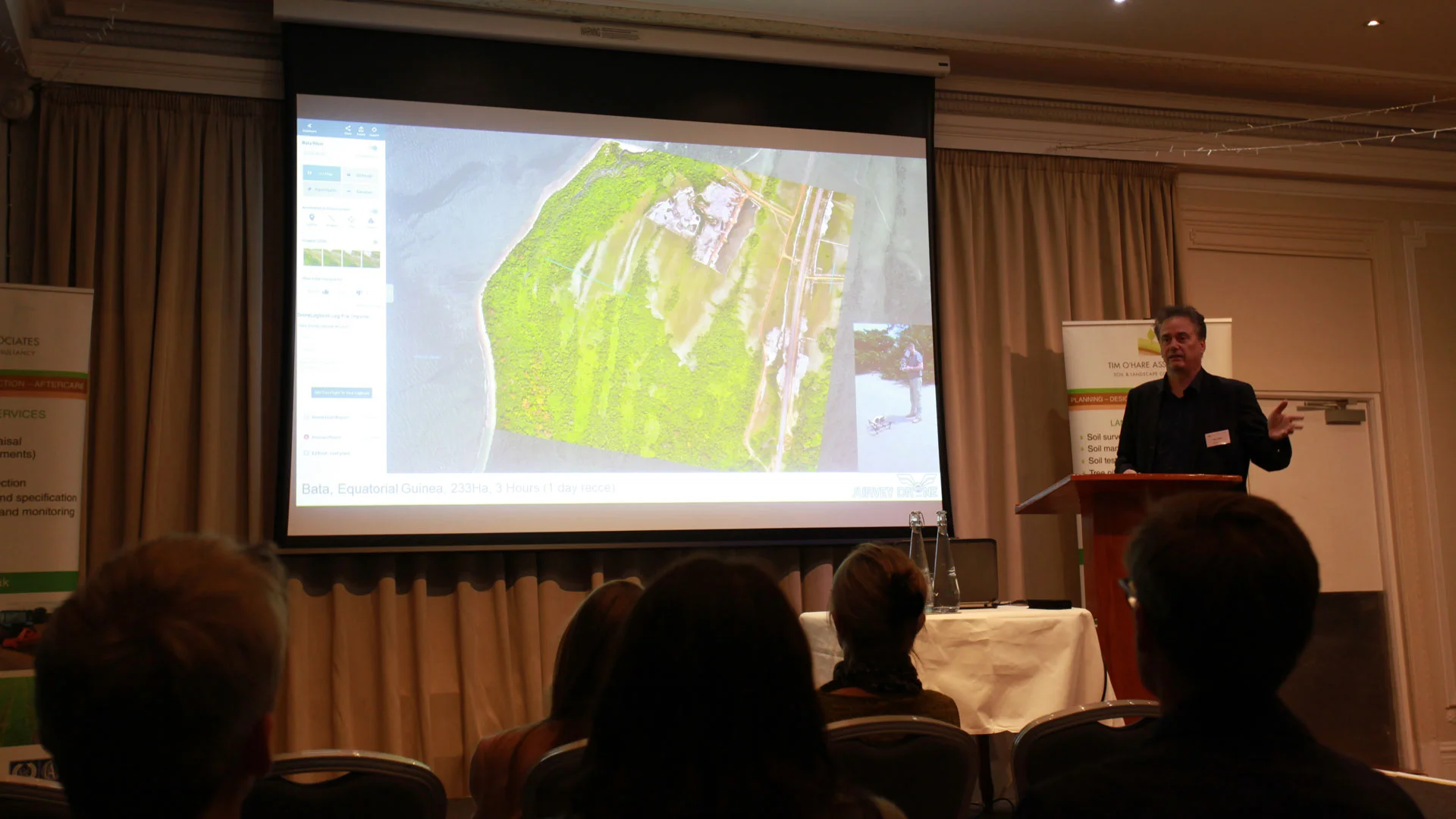
We recently spoke at another well attended event hosted by Tim O'Hare Associates at the prestigious Phyllis Court in Henley on Thames. A presentation was given on the use of drones in site appraisal and assessment work which was followed by a demonstration of automated waypoint flying with our Inspire 1 UAV. All permissions were in place and a full site risk assessment carried out prior to the operations and we are pleased to report that the aircraft returned safely and landed within 10cm of the take-off point after completing an eight minute mission. 

If you would like Survey Drone to visit your site and provide a demonstration of our survey technology then please email us or fill out the enquiries form and we will advise you of our availability and the feasibility of flying at your location.

Pres-1.jpg
demo-5.jpg
demo-4.jpg
Demo-1.jpg

Equatorial Guinea Filming

The team were recently out in the far flung reaches of Equatorial Guinea filming and surveying two 500Ha sites. Whilst the humidity and overcast conditions presented some problems, the location more than made up for it. Trying to get LIPO batteries through local security often proved difficult on internal flights and lost and delayed baggage hampered efforts somewhat. All in all the mission was a success and paves the way for future overseas projects, having mastered the logistics of operating in remote areas.

EG-1.jpg
EG-3.jpg

Drone Demonstration at University of Greenwich

On the 21st of April Survey Drones Inspire 1 multi-rotor UAV was flown in the Crit Pit of the University of Greenwich. Highlighting a wide variety of applications from filming to 3D modelling, the demonstration was the culmination of a 13 week course on Landscape Science and Techniques teaching BA Landscape Architecture students the fundamentals of geology, hydrology and terrain modelling.

Stockwell-Street-Campus-1000x600.jpg
Drone-demo.jpg
Drone-demo-2.jpg